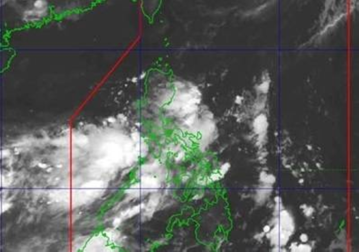
Pagasa tracks a new LPA 495 km northwest of Palawan, likely to enter PAR Thursday or Friday. Habagat dumps 50-100 mm rain on 12 Luzon areas. Flash flood risk rises.
A new low-pressure area has formed outside the Philippine Area of Responsibility, roughly 495 kilometers northwest of Pagasa Island in Kalayaan, Palawan. The Philippine Atmospheric Geophysical and Astronomical Services Administration (Pagasa) reported the system early Wednesday and expects it to enter PAR either Thursday or Friday.
Weather specialist Aldczar Aurelio said Pagasa will track the LPA's movement to determine its direction. The system's entry into PAR shifts the near-term weather narrative for the western Philippines, particularly for regions already under the influence of the southwest monsoon, or habagat.
The LPA's position outside PAR gives forecasters a 24- to 48-hour window before it crosses the boundary. Pagasa's 5 a.m. briefing placed the system northwest of Kalayaan, a location that typically precedes a westward or northwestward track. If the LPA maintains its current speed and direction, it could enter PAR late Thursday or early Friday. The exact timing will determine how quickly it interacts with the habagat and whether it strengthens into a tropical depression.
Even before the LPA enters PAR, the southwest monsoon is already dumping heavy rain across at least 12 Luzon areas. Metro Manila, Pangasinan, Zambales, Bataan, Tarlac, Pampanga, Bulacan, Cavite, Batangas, Occidental Mindoro, and Palawan face moderate to heavy rain within the next 24 hours. Pagasa forecasts 50 to 100 millimeters of rainfall in a single day from the habagat alone.
Flash floods and landslides are possible in these areas, especially in low-lying and mountainous terrain. The combination of monsoon rain and an approaching LPA raises the risk of prolonged wet conditions. The rest of the country will see partly cloudy to overcast skies with isolated thunderstorms.
The key variable is whether the LPA intensifies once inside PAR. A stronger system would amplify the monsoon trough and extend the heavy rain period. Pagasa's monitoring updates over the next 48 hours will be the primary input for local disaster response and for sectors sensitive to weather disruptions, such as agriculture, logistics, and utilities. The LPA's track relative to Luzon's western coast will determine which provinces face the highest flood risk.
For now, the immediate concern is the habagat's rainfall totals. The 50-100 mm range already exceeds typical daily thresholds for flood-prone areas. If the LPA adds its own moisture, those totals could double. Residents and operators in the affected zones should watch Pagasa's afternoon and evening bulletins for any shift in the LPA's speed or direction.
Prepared with AlphaScala research tooling and grounded in primary market data: live prices, fundamentals, SEC filings, hedge-fund holdings, and insider activity. Each story is checked against AlphaScala publishing rules before release. Educational coverage, not personalized advice.