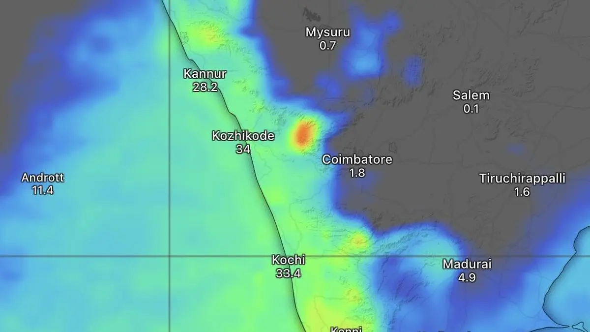
Thunderstorm activity arrives 40 days ahead of the typical June 1 monsoon onset. This shift forces agricultural supply chain adjustments and risk modeling.
The India Meteorological Department (IMD) has issued an alert for a significant uptick in thunderstorm activity across Kerala, beginning Wednesday, April 22. This intensification of pre-monsoon weather patterns arrives approximately 40 days before the typical onset of the monsoon season, which usually begins on June 1.
The shift in weather patterns comes amid broader concerns regarding the influence of El Niño on seasonal precipitation. While the upcoming thunderstorm activity provides a localized increase in moisture, the long-term outlook for the monsoon remains under scrutiny. Meteorologists are currently relying on data from the European Centre for Medium-Range Weather Forecasts to refine models for the coming months.
This early peak in activity serves as a critical data point for agricultural and infrastructure planning in the region. As weather volatility impacts regional supply chains, investors often monitor these shifts for potential effects on stock market analysis related to the agricultural and commodities sectors. The current forecast suggests that while the immediate period will see increased rainfall, the broader monsoon trajectory remains subject to the ongoing effects of global climate phenomena.
Prepared with AlphaScala editorial tooling from the source reporting linked above. Indexable analysis may include a cited Alpha Score value. Publishing checks screen each story before release. Educational coverage, not personalized advice.