Commodities● Neutral
How Satellite Reconnaissance Changes Commodity Risk Pricing
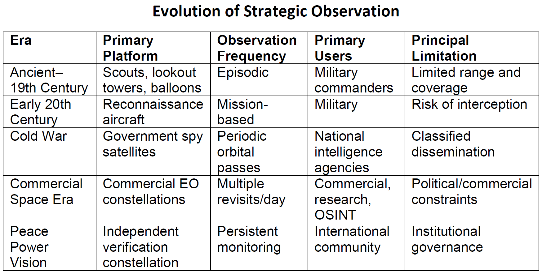
Satellite reconnaissance is moving from government monopoly to commercial industry, changing how commodity traders price geopolitical risk. An independent system could cut uncertainty.
Continue with
The evolution of satellite observation from government monopoly to commercial industry is reshaping how geopolitical risk gets priced in commodity markets. Military spy satellites once gave national leaders a private view of troop movements, missile deployments, and military construction. Commercial operators like Maxar and Planet now sell that same observational power to grain traders, oil analysts, and hedge funds. The result is lower information asymmetry for well-funded market participants – but new vulnerabilities emerge when governments restrict access during crises.
The essay "Coffee Break: Armed Madhouse – From Spy Satellites to Peace Satellites" argues the next step is institutional. It calls for an independently governed satellite observation system that produces trusted public evidence, not national intelligence. Proponents of such "Peace Satellites" say they would reduce uncertainty in conflicts, support treaty verification, and give traders a more reliable baseline for pricing geopolitical risk.
How commercial imagery cuts the risk premium
Until recently, high-resolution satellite imagery was a government monopoly. The U.S. CORONA program and its Soviet counterparts gave intelligence agencies unmatched visibility. Revisit rates have climbed since then: many locations now get photographed multiple times per day. Open-source intelligence analysts use that data to track oil tankers, monitor grain storage, and verify ceasefire violations.
For commodity traders, the shift cuts both ways. Better imagery means faster confirmation of supply disruptions. A destroyed pipeline, a blocked port, or a sudden military buildup near a key shipping lane can be spotted within hours, not days. That reduces the information advantage of a few large players. The essay notes that NASA's FIRMS thermal anomaly system, built for wildfire detection, has been used by analysts to corroborate artillery strikes in Ukraine, providing independent confirmation of battlefield events that affect grain and energy flows.
Where the commercial model falls short
Governments still control licensing. The essay cites the Kyl-Bingaman Amendment, which restricted high-resolution imagery of Israel and the Palestinian territories until 2020. Even after relaxation, public mapping platforms continued to show lower-resolution data than technically available. During the recent war with Iran, several commercial providers delayed or restricted public access to imagery over the conflict zone. Some actions followed government requests. Others reflected company policy. Either way, independent verification became harder precisely when it was most needed.