The monsoon is turning aggressive over West and Central India. The India Meteorological Department warned Friday that extremely heavy rain may hit Konkan, Madhya Maharashtra, Saurashtra and Kutch over the next four days, with east Gujarat facing two more days of heavy downpours.
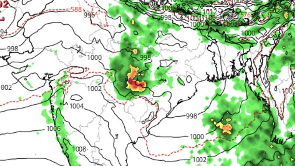
The trigger is a strengthening low-pressure area over the north-west Bay of Bengal. That system is pulling moisture inland along the monsoon trough, which now stretches from north-west Rajasthan across north Madhya Pradesh, north Chhattisgarh and Odisha. The offshore trough along the west coast has weakened and is now pinned to the Maharashtra-Karnataka coast.
The 24 hours ending Friday morning delivered extremely heavy rainfall – 21 cm or more – over Odisha, the IMD said. Very heavy rain of 12-20 cm hit the Andaman and Nicobar Islands, Madhya Pradesh, Chhattisgarh, Konkan, Madhya Maharashtra and Vidarbha. Heavy rain also fell over Jammu and Kashmir, Uttar Pradesh, East Rajasthan, Coastal and South Interior Karnataka, Assam and Nagaland.
The monsoon's northern limit now runs through Jamnagar, Udaipur, Ajmer, Jhunjhunu, Hisar and Bathinda. The IMD expects conditions to stay favourable for further advance into remaining parts of Haryana and Punjab, plus more areas of Gujarat and Rajasthan, over the next four to five days.
The Bay low may intensify into a more marked system within two days once it moves fully over warmer sea waters, the IMD said. That would sustain the heavy rain pattern through mid-week.
Beyond the current deluge, the forecast shifts. The US National Weather Service's Climate Prediction Centre expects below-normal rainfall over much of the northern Indian Ocean and southern India during July 8-21. IMD's numerical models show the heavy rain belt could migrate to the Himalayan foothills during that period, signalling a possible break-monsoon phase. In that scenario, rainfall retreats from Central and North-West India to the foothills, parts of North-East India, and sections of the east coast including Tamil Nadu.
Another model suggests the ongoing wet spell may persist until July 11 before easing over North-West India, Madhya Maharashtra and Marathwada. By late July, a fresh dry spell may spread across North-West India, Gujarat and west Madhya Pradesh, while above-normal rainfall stays largely confined to the southern peninsula.
Central India, east Uttar Pradesh, Bihar, West Bengal and the North-East may receive near-normal rainfall during this phase. Early indications for August suggest the dry pattern may continue over North-West and parts of Central India, while eastern and southern India are likely to see near-normal rainfall.